Explore the Districts of Karnataka

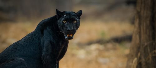
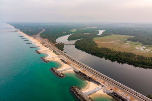
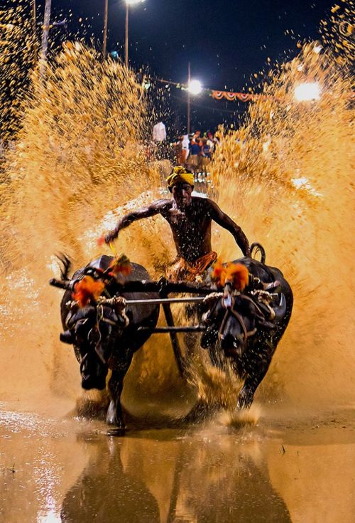
Come and explore the hidden gems of Karnataka. The sixth largest state in India is famous for its wildlife, heritage, temples, monuments, beaches, adventure, food and much more.

EXPLORE ALL

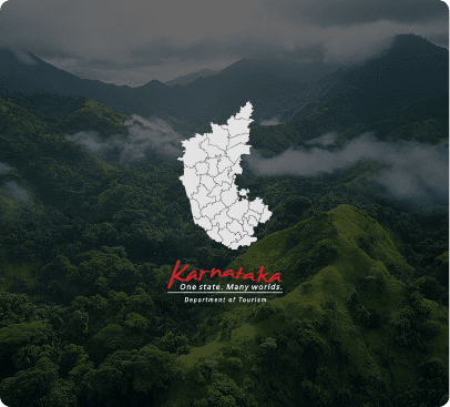
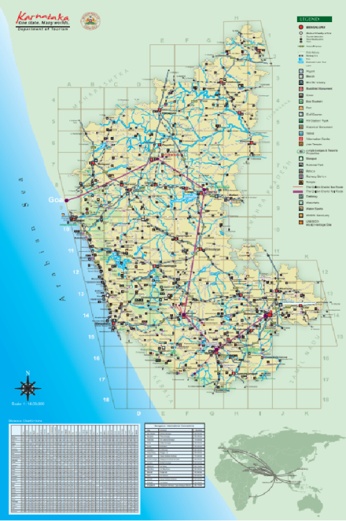
karnataka map
Belagavi Bangluru Urban Bidar Kalaburgi Vijayapura Yadgiri Bagalkote Raichur Dharwad Gadag Vijayanagara Koppal Ballari Uttara Kannada Haveri Shivamogga Udupi Chikkamagaluru Dakshina Kannada Hassan Tumakuru Bangalore Rural Chikkaballapur Davanagere Chitradurga Kodagu Kolar Mandya Ramanagara Mysuru Chamrajnagar

Belagavi

Belagavi was originally known as Velugrama or Venugrama as per historical records and it literally meant “bamboo village”. Venu stands for bamboo which is found abundantly in these areas. Belagavi is surrounded by Uttara Kannada and Dharwad in the south, Bagalkote and Gadag in the east, Maharashtra state in the north and Goa state in the west. Belagavi is one of the oldest cities of Karnataka and is the largest in terms of size.

VIEW ALL

Bangluru Urban

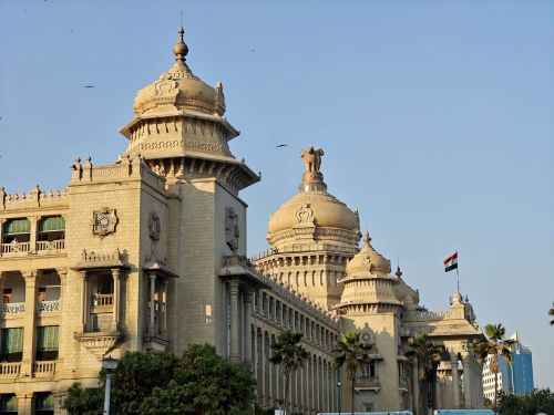
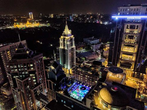
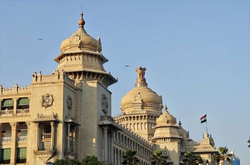
Located 949 m above sea level in South India, Bengaluru is a fast-paced amalgam of the old and new. It is an exciting destination with tantalising sights to take in, mixed with the sensations of a happening cosmopolitan city. Bengaluru is more than just a city; it is a vibrant melange of the past, present and future, a potpourri of experiences unlike any other! With its cosmopolitan nature, Bengaluru welcomes you into its fold.
VIEW ALL

Bidar

Bidar, situated in the heart of the Deccan Plateau, has been a melting pot of cultural influences. A region that has seen dramatic changes in the course of its history, it is home to magnificent monuments. Ruled by the Kakatiyas, Tughlaqs, Bahamanis, Barid Shahis, Adil Shahis, Mughals and Nizams at different times, the architecture shows an interesting intermingling of Hindu, Turkish and Persian styles.

VIEW ALL

Kalaburgi

Situated in the North Karnataka region, the district of Kalaburagi (formerly called as Gulbarga) forms part of the Deccan Plateau and shares its borders with Maharashtra and Telangana. Among the three districts of the former Hyderabad Karnataka area, it became part of Mysore (Karnataka) after the reorganization of States in 1956. Kalaburagi district is surrounded by Yadgir in the south, Vijayapura and Maharashtra in the west, Bidar in the north and Telangana State in the east.

VIEW ALL

Vijayapura

Vijayapur was a gateway to the Deccan Sultanate which extended from North Karnataka to central India. Located in the historically rich Deccan, the city was established in the 10th-11th centuries by the Kalyani Chalukyas and was ruled by various dynasties including the Adil Shahi kings who have had a major influence on the region. It is dotted with mosques, mausoleums, palaces, fortifications, watchtowers, and strong gateways, with the massive Gol Gumbaz dominating the landscape for miles around.

VIEW ALL

Yadgiri

Yadgiri is one of the smallest districts of Karnataka and it is located in the northeastern part of the state. It is surrounded by Kalaburgi in the north, Raichur in the south, Vijayapura in the west and Telangana state in the east. The major crops include Jowar, Paddy, Cotton, Sunflower, Groundnut and Sugarcane. The area is also renowned for its vast stretch of fertile black soil which is the main reason for bumper harvests especially of red gram, hence the district is also referred to as the “Daal Bowl” of the state.

VIEW ALL

Bagalkote

Situated in the northern part of Karnataka is Bagalkote. Bagalkote is flanked by Vijayapura in the north, Gadag in the south, Raichur towards east, Koppal towards southeast and Belagavi towards the west. The Ghataprabha River, Malaprabha River and Krishna River flow through the district.The legendary Chalukya Dynasty ruled over the place in and around Bagalkote.

VIEW ALL

Raichur

Geographically, the district is surrounded by Kalaburagi in the north, Vijayapura and Bagalkote in the west, Koppal and Ballari in the south and Andhra Pradesh State in the east. Raichur is an important commercial, industrial and education centre in North Karnataka.Raichur lies between two important rivers, the Krishna and the Tungabhadra, in the north eastern part of Karnataka state.

VIEW ALL

Dharwad

Dharwad is located in the north western part of Karnataka. Geographically, This place is surrounded by Gadag in the east, Belagavi in the north, Uttara Kannada in the southwest and Haveri in the south. Dharwad had been a part of many dynasties and kings including the Chalukyas, Bahmani Sultanate, Vijayanagara Empire, Adil Shahis, Mughals, Shivaji Maharaj, Peshwa Balaji Baji Rao, Hyder Ali, Tipu Sultan and finally the British East India Company.

VIEW ALL

Gadag

Gadag district was formed in 1997 when it was carved out from Dharwad district. Gadag is surrounded by Haveri in the south, Dharwad in the west, Belagavi in the north west, Bagalkote in the north, Koppal in the east and Ballari in the south east.

VIEW ALL

Vijayanagara

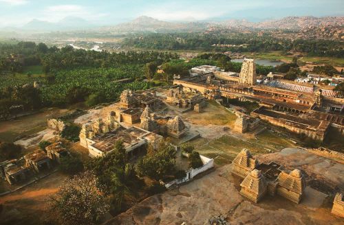
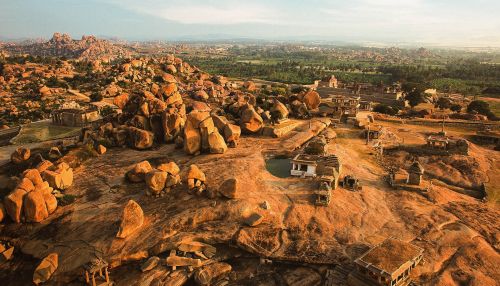
The newest and the 31st District in Karnataka state carved out of Ballari District in 2020 is located in the Kalyana Karnataka Region with Hosapete as district headquarters. It is the home of the former capital of the famous Vijayanagara Empire and its capital Hampi, which is one of the UNESCO World Heritage Sites.

VIEW ALL

Koppal

Koppal is a fairly new district of Karnataka which has been carved out of Raichur district. It is surrounded by Raichur in the east, Gadag in the West, Bagalkot in the north, Ballari in the south.The UNESCO World Heritage Site of Hampi also covers some areas of Koppal district including Anegundi, which is home to the mythical kingdom of Kishkinda of Ramayana fame.The old palace and fort still exist here and is the location for the annual “Anegundi Utsava”.

VIEW ALL

Ballari

Ballari is situated on the eastern side of Karnataka and is surrounded by Raichur and Koppal on the north, Haveri and Gadag on the west, Chitradurga and Davanagere on the south, and Anantapur and Kurnool (Andhra Pradesh) on the east. Ballari has been a meeting place for people from Karnataka and Andhra Pradesh hence offering a tradition and culture mix of both the states.

VIEW ALL

Uttara Kannada

Uttara Kannada District is one of the largest districts in Karnataka with abundant natural resources and varied geographical features. It is surrounded by Belagavi and Goa State to the North, Dharward in the East, Shivamogga and Udupi in the South. Kannada & Konkani are the 2 major regional languages spoken here. With a total land area of 10.25 lakh hectares, 8.28 hectares is under forest land.

VIEW ALL

Haveri

Haveri district is almost in the centre of Karnataka with equal distance from Bidar in the far north to Kollegal in the far south. It is surrounded by Dharwad and Gadag in the north, Ballari and Davanagere in the east, Shivamogga in the south and Uttara Kannada in the west. Haveri is well known for its rich culture and heritage and is considered as the gateway to North Karnataka.Haveri is the birthplace of several prominent personalities such as Santa Shishunala Sharif, Kanaka Dasa and Sarvajna.

VIEW ALL

Shivamogga

Shivamogga district is a part of the Malnad region of Karnataka. This landlocked district is surrounded by Haveri, Davanagere, Chikkmagaluru, Udupi and Uttara Kannada districts and is located 300 km north-west of Bengaluru. Nestled cosily as a Gateway to the Western Ghats, the Shivamogga region is a lush green landscape well-endowed with forests, sparkling water bodies, spectacular waterfalls and green peaks rising to the skies.

VIEW ALL

Udupi

The name “Udupi” is believed to have come from the Sanskrit words “Udu & Pa” that means “stars” and “Lord“. According to legend, the Moon’s light was once reduced due to a curse by King Daksha. The Moon prayed to Lord Shiva to get back the original shine and the prayer was believed to be made at the Chandramouleshwara Temple here.

VIEW ALL

Chikkamagaluru

Chikkamagaluru is a peaceful, beautiful town with hills, valleys, streams and coffee plantations. It is believed that Chikkamagaluru was given as a dowry to the younger daughter of Rukmangada, the Chief of Sakrepatna kingdom. Chikkamagaluru has taken its name from Chikka magal-uru which means “Younger Daughter’s Village“.

VIEW ALL

Dakshina Kannada

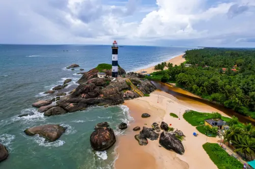
Ensconced on the southern coast, this maritime city makes a pleasant and convenient stop between Kerala and Karwar. It’s the gateway to the Konkan coast and inland Kodagu region. The district is bound by sea in the west and Western Ghats in the East, Udupi district in the North and Kerala State in the South. Mangaluru is the district headquarters of Dakshina Kannada and it has been synonymous with banking and education.

VIEW ALL

Hassan

Surrounded by Dakshina Kannada in the west, Chikkamagaluru and Chitradurga in the north, Coorg towards the south and Tumkuru in the east, Hassan has an eventful and rich history. It is blessed with a pleasant climate and a great picturesque location. It is here where the plains (maidaans) begin to gently slope into the Western Ghats (malnad).Although not a proper hill station, Hassan is often referred to as Poor Man’s Ooty.

VIEW ALL

Tumakuru

Located around 65 km from Bengaluru, Tumakuru is the second-largest district in the state of Karnataka. Tumakuru district shares its border with eight districts, which is the highest in the state; Chitradurga towards the north, Hassan and Chikkamagaluru towards west, Mandya towards the south-west, Ramanagara and Bengaluru Rural towards the south, Chikkaballapura towards east and Ananthapuram (Andhra Pradesh) towards north-east.

VIEW ALL

Bangalore Rural

Bengaluru Rural is surrounded by Bengaluru Urban in the south, Tumkuru and Chikkaballapur in the north, Kolar in the east and Ramnagara in the west. Bengaluru Rural District was formed in 1986 when Bengaluru was split into Bangalore (Rural) and Bangalore (Urban). Again, it was spilt in 2007, when the talukas of Kanakapura, Ramanagar, Magadi and Channapatna merged to the newly formed Ramanagara district.

VIEW ALL

Chikkaballapur

Chikkaballapur district is a newly created district in the state of Karnataka. Chikkaballapur was formed in 2007 when it was carved out of the existing Kolar district. The district is surrounded by Kolar in the southwest, Bengaluru Rural in the south, Tumkuru in the west and Andhra Pradesh state in the north. Chikkaballapur is located around 60 km from Bengaluru city and due to this proximity, attractions in Chikkaballapur is a favourite weekend getaway for the Bengaluru crowd.

VIEW ALL

Davanagere

In 1997, Davanagere district was carved out of 3 districts of Chitradurga, Shivamogga and Ballari and derives its name from Devanagari which gradually became Davanagere. It is surrounded by Ballari in the north, Shivamogga and Haveri in the west, Chikkamagaluru in the south and Chitradurga in the east.

VIEW ALL

Chitradurga

Chitradurga offers visitors an irresistible mix of history, legends and spirituality. Chitradurga offers visitors a spectacular boulder-strewn landscape which has an unconquerable fort with astounding defenses, ancient temples and a history full of valour and bravery.It is believed that the name of the place earlier was ‘Chatrakaldurg ‘, the word ‘Chatrakal’ meaning umbrella rock, being derived from a striking umbrella-shaped hill in the south-western part of the town.

VIEW ALL

Kodagu

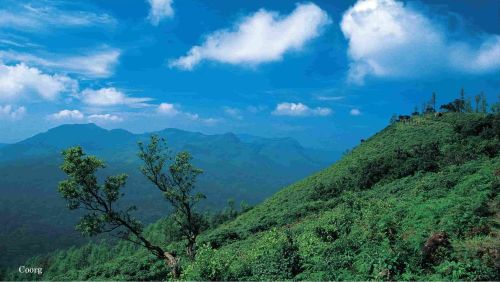
Nestled on the slopes of the Western Ghats, Coorg (also called Kodagu) woos you with its undulating hills, lush green forests and a spectacular landscape dotted with coffee plantations and orange groves. Coorg is the land of coffee, cardamom, colonels, and the Cauvery. Aptly dubbed as ‘the Scotland of India’, Coorg offers a spellbinding visual treat with its cloud-capped peaks, chirpy birds and sparkling streams, not to mention the unique, mouth-watering flavours of Kodagu cuisine.

VIEW ALL

Kolar

It was, in ancient inscriptions, known as Kuvalala, Kolala and Kolahalapura. Historical evidence says that Kolar was in existence from the 4th Century onwards. The Ganga dynasty originally hailed from this place which was the initial capital. Moreover, Kolar was also part of many other dynasties including Cholas, Hoysalas and Vijayanagara. Moreover, it also has mentioned in the Indian epics Ramayana and Mahabharata.

VIEW ALL

Mandya

Geographically, Mandya is surrounded by Tumkuru in the north, Ramanagara in the east, Chamrajanagara and Mysuru in the south and Hassan in the west. Mandya is also known as the land of five rivers due to the presence of the rivers Cauvery, Hemavathi, Shimsha, Veeravaishnavi and Lokapavani.

VIEW ALL

Ramanagara

Ramanagara was called Closepet during pre-independence times, named so after Sir Barry Close who built the old bridge here. Ramanagara district was carved out of the erstwhile Bengaluru Rural district in 2007. The district is surrounded by Bangalore Urban and Tumakuru in the north, Mandya in the west, Chamarajanagar in the south and Tamil Nadu state in the west. Cauvery, Arkavathi & Kanva are the three rivers flowing in the District.

VIEW ALL

Mysuru

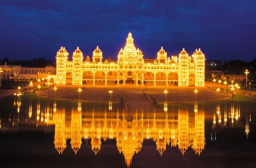
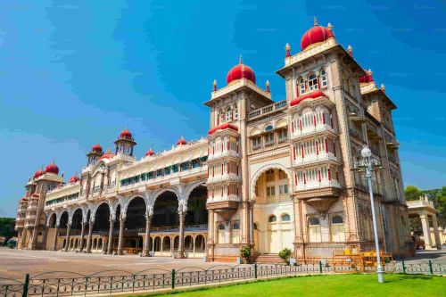
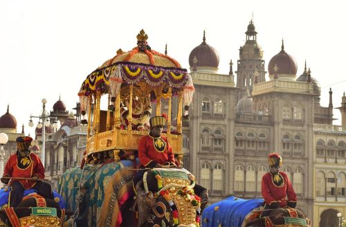
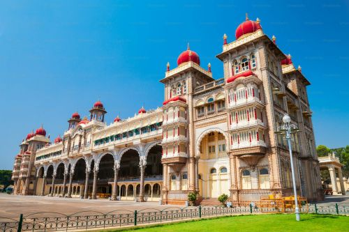
Mysuru, the ‘City of Palaces’, is royalty and magnificence embodied; overflowing with history, sprawling gardens and tree-lined boulevards. One of South India’s most fascinating cities, Mysuru has a plethora of places to visit and explore. Ruled over by the Wadiyars from 1399 till Independence, Mysuru is renowned for its royal heritage and splendid monuments and buildings. This former state capital is a seamless blend of old-world charm and modernity.

VIEW ALL

Chamrajnagar

Being the southernmost district of Karnataka, Chamarajanagar district shares its borders with the states of Tamil Nadu and Kerala. Chamarajanagar was earlier known as Arikutara, which was changed by Krishnaraja Wadiyar III in memory of his father Chamaraja Wadiyar who was born at this place and also constructed the Chamarajeshwara Temple, a monument of considerable beauty.

VIEW ALL